|
|
 |
|
Lawrenceburg - Lawrence County Airport
Location
| FAA Identifier: |
2M2 |
| Lat/Long: |
35-14-03.489N / 087-15-28.556W
35-14.05815N / 087-15.47593W
35.2343025 / -87.2579322
(estimated) |
| Elevation: |
936 ft. / 285.3 m (surveyed) |
| Variation: |
01W (1995) |
| From city: |
3 miles NE of LAWRENCEBURG, TN |
Airport Operations
| Airport use: |
Open to the public |
| Sectional chart: |
ATLANTA  |
| Control tower: |
no |
| ARTCC: |
MEMPHIS CENTER |
| FSS: |
JACKSON FLIGHT SERVICE STATION [1-800-WX-BRIEF] |
| NOTAMs facility: |
MKL (NOTAM-D service available) |
| Attendance: |
8:00 a.m. - 5:00 p.m. |
| Wind indicator: |
lighted |
| Segmented circle: |
yes |
| Lights: |
DUSK-DAWN |
| Beacon: |
white-green (lighted land airport) |
Airport Communications
| CTAF/UNICOM: |
122.8 |
| WX AWOS-3: |
120.175 (931-766-1585) |
| WX AWOS-3 at GZS (11 nm SE): |
118.275 (931-363-6760) |
| WX AWOS-3 at MRC (20 nm N): |
128.625 (931-379-0844) |
- APCH/DEP SERVICE PROVIDED BYMEMPHIS ARTCC ON FREQS 125.85/379.25 (GRAHAM RCAG).
Nearby radio navigation aids
| VOR radial/distance |
|
VOR name |
|
Freq |
|
Var |
| MSLr019/33.7 |
|
MUSCLE SHOALS VORTAC |
|
116.50 |
|
01E |
| GHMr162/37.2 |
|
GRAHAM VORTAC |
|
111.60 |
|
03E |
| DCUr337/38.5 |
|
DECATUR VOR/DME |
|
112.80 |
|
01W |
| NDB name |
|
Hdg/Dist |
|
Freq |
|
Var |
|
ID |
| LAWRENCEBURG |
|
at field |
|
269 |
|
00E |
|
LRT |
.-.. .-. - |
| HOHENWALD |
|
128/22.8 |
|
257 |
|
01W |
|
JHG |
.--- .... --. |
| MAURY COUNTY |
|
201/23.9 |
|
365 |
|
01W |
|
PBC |
.--. -... -.-. |
| VERONA |
|
234/27.1 |
|
251 |
|
00W |
|
LUG |
.-.. ..- --. |
| KELSO |
|
281/35.6 |
|
358 |
|
01W |
|
TNY |
- -. -.-- |
| CAPSHAW |
|
321/36.3 |
|
350 |
|
01W |
|
CWH |
-.-. .-- .... |
Airport Services
| Fuel available: |
100LL JET-A |
| Parking: |
hangars and tiedowns |
| Bottled oxygen: |
NONE |
| Bulk oxygen: |
NONE |
Runway Information
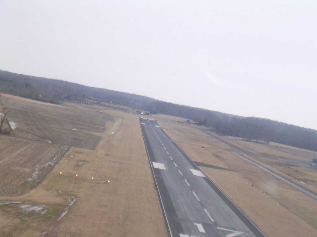
Runway 17/35
| Dimensions: |
5003 x 100 ft. / 1525 x 30 m |
| Surface: |
asphalt, in good condition |
| Weight limitations: |
|
| Runway edge lights: |
medium intensity |
|
RUNWAY 17 |
|
RUNWAY 35 |
| Latitude: |
35-14.45913N |
|
35-13.65713N |
| Longitude: |
087-15.59368W |
|
087-15.35967W |
| Elevation: |
936.0 ft. |
|
927.0 ft. |
| Traffic pattern: |
left |
|
left |
| Runway heading: |
168 magnetic, 167 true |
|
348 magnetic, 347 true |
| Markings: |
nonprecision, in good condition |
|
nonprecision, in good condition |
| Visual slope indicator: |
4-light PAPI on left |
|
4-light PAPI on left |
| Runway end identifier lights: |
yes |
|
yes |
| Touchdown point: |
yes, no lights |
|
yes, no lights |
| Obstructions: |
78 ft. pole, 1437 ft. from runway, 2 ft. right of centerline, 15:1 slope to clear |
|
53 ft. trees, 1050 ft. from runway, 97 ft. right of centerline, 16:1 slope to clear |
Airport Operational Statistics
| Aircraft based on the field: |
|
17 |
| Single engine airplanes: |
|
15 |
| Multi engine airplanes: |
|
1 |
| Ultralights: |
|
1 | |
|
 |
|
| Aircraft operations: avg 37/day |
| 66% |
transient general aviation |
| 33% |
local general aviation |
| <1% |
military | |
Lawrenceburg - Lawrence County Airport
|
|
|
|
Lawrenceburg - Lawrence County Airport *
410 Airport Road * Lawrenceburg, TN 38464
931-762-5133
|
|
|
|
